Biography
GIS practitionner with 6 years of professional experience (4 working as a fulltime GIS Analyst). Highly experienced in geospatial data acquisition through techniques such
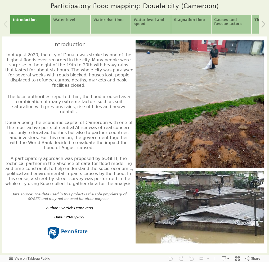
Remote sensing (Optical and radar), photogrammetry (drone), GPS surveys for high precision data and ODK collect, Kobo collect and QField for socio-economical
data collection. Data Quality assessment (QA), Data management, analysis and Monitoting and Evaluation (M&E) are also important aspects of my experience working as a GIS
professional.
Education : Masters in Spatial Data Science | Pennsylvania State University | USA
Graduate Certificate in Geospatial Programming | Pennsylvania State University | USA
Masters in Engineering (MEng) in Land and Surveys | National Advance School of Public Works | CAMEROON
Skills : Data collection, Data management, Monitoring and Evaluation (M&E) and reporting, Data Analysis, Data Visualization, GIS Training, Project management
Inter-personal Skills: Funny, Team player, respectfull and ready to learn.
Languages : Fluent in speaking, reading and writing of both French and English.
Softwares : powerBI, Tableau, ArcGIS (ArcGIS pro, ArcGIS Online), QGIS, AutoCAD, ODK, Kobo Collect, QField, Excel, Word, PowerPoint, Access, Postgres/postGIS, KNIME
Programming : Python, HTML, CSS, JavaScript, SQL, R
Libraries / Frameworks : Leaflet, ArcGIS JS API, ArcPy
Countries Worked in : Senegal, Mauritania, Benin, Burkina-Faso and Cameroon